
Advertisement
Charteo: Download PowerPoint Slides, Diagrams And 3D Graphics
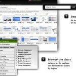
Charteo is a web service which offers a comprehensive set of options to select and download presentation sets. At Charteo you can select professionally made slides for your presentations and download them for editing in MS PowerPoint. You can begin by searching for relevant slides that are listed by category. Other than PowerPoint templates, Charteo …