Use a Map from Google Maps in PowerPoint Presentations
Last updated on November 25th, 2024
If you need to use maps in your presentations then you can generate them in Google Maps and here we will explain you how to extract maps from Google Maps and use them in PowerPoint. This is great to extract and insert Google Maps’ maps into PowerPoint presentations or maps PowerPoint templates.

Here we will show you how to extract a map of New York city and embed it in PowerPoint. For this purpose, we can use the Google Maps API but the drawback here is that we are limited in the map size unless we have a premium account.
But instead we can use Google Maps Saver, a simple but powerful tool that we can use to extract big maps from Google Maps and then capture and use them in our presentations.
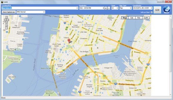
We can specify the map type, the coordinates, the output settings (PNG, JPG, etc.) as well as the output size of the map.
Then we can save the map and generate an image like the following sample using the NY map.
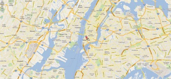
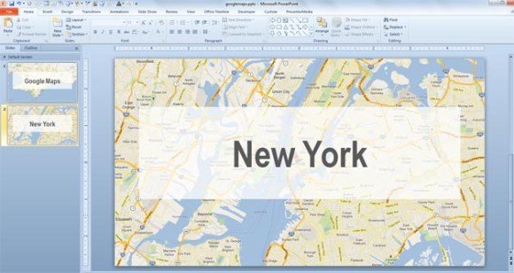
Finally, insert the JPG or PNG image into your PowerPoint slides. If you prefer, you can create a template and use it as a background.
We hope this article helped to understand how to insert Google Maps in PowerPoint. You can also use the same concept to embed maps into your PPT contact slide templates or any other PowerPoint template. Remember you can download free maps and free PPT templates from FPPT to use in your PPT presentations, or download an editable US map template for PowerPoint.
Hi,
How can I download the template for using an embedded google map in power point?
Thanks in advance.
Antxoka